")
Plan a Summer Road Trip Along These 4 Ohio Scenic Byways
Take the long way this season with these routes that offer glimpses of the Buckeye State’s nature, history and heartland.
Amish Country Byway
Holmes County is the heart of Ohio’s Amish Country and has one of the largest concentrations of Amish and Mennonite communities in the world. Unlike Ohio’s more linear byway routes, the 190-mile Amish Country Byway starts near Utica on state Route 62 in Knox County before spiderwebbing out across 13 different roads.
“When you’re out traveling in the springtime, you’re going to see horses and plows, you’re going to see women and men planting gardens [and] children helping outside,” says Sharon Strouse, executive director of the National Scenic Byway Foundation and a resident of Holmes County.
There are plenty of sites to visit along the way, including the Millersburg Glass Museum and the Victorian House Museum, which are both housed in one location. Here, travelers can learn more about the Millersburg Glass Co. and tour a 28-room Victorian-style mansion.
Heading east from Millersburg, several bakeries and cheese makers line the route. Hershberger’s Farm and Bakery just west of Berlin offers family entertainment like an adorable farm animal petting zoo, and Guggisberg Cheese Factory north of the village of Charm is known for its famous Baby Swiss variety.
Farther east, the route unfolds into the communities of Walnut Creek and Sugarcreek, which offer a wealth of stops for home decor, authentic foods prepared from traditional recipes and comfortable places to stay.
“Soak in the differences,” Strouse says. “Don’t be afraid to get off the most traveled roads and go to the back roads as well.” 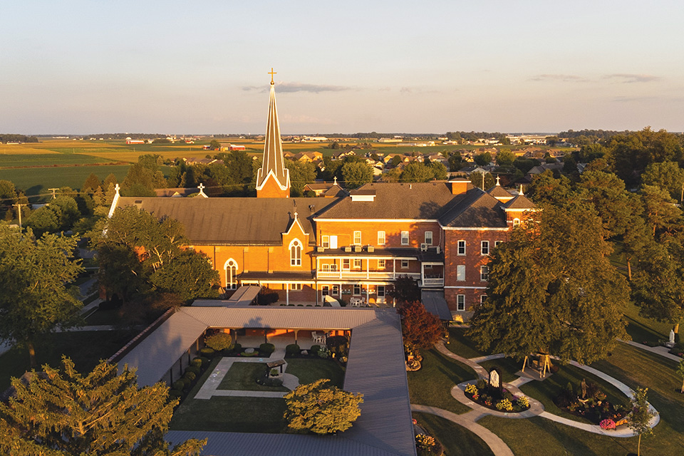
Land of the Cross-Tipped Churches
Spanning 45 miles across Auglaize, Mercer, Darke and Shelby counties, this byway mainly follows state Routes 49 and 119 as it passes by roughly 50 historic buildings with religious significance.
“The buildings consist of churches, convents, schools, rectories and seminaries,” says Mark Travis, executive director of the Maria Stein Shrine of the Holy Relics. “They were all originally here because of the work from the Precious Blood community that was ministering to the larger population of German Catholics.”
The Saint Charles Senior Living Community in Celina got its start as a seminary for young men in the early 1860s by the Missionaries of the Precious Blood before it closed in 1969. The structure was later renovated and became a nonprofit retirement community, which can be visited for Mass in the chapel.
The “epicenter” of the byway, Travis says, is the Maria Stein Shrine of the Holy Relics. Established in 1846, visitors to this historic location can pray in the presence of a large collection of relics, tour the museum and visit the gift and bake shops.
To the east in Minster, St. Augustine Church was one of the first places that German Catholics settled in the region. Their church, which was established in 1836, was a mother parish of the area. Like so many other churches along the byway, this one boasts crosses at the top of its tall spires that stretch toward the sky.
“There’s a very unique architecture many of them have,” Travis says, “including the spire and the cross.”
Lower Valley Pike
Although it covers just 11 miles, the Lower Valley Pike byway is packed with both natural beauty and local history. The route follows the path of the Mad River as it heads southwest from Springfield, ending just north of Wright-Patterson Air Force Base near Dayton.
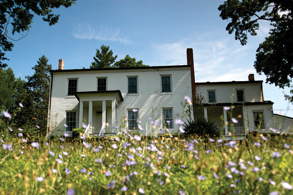
Springfield sits at the eastern end of the byway, where travelers will find the 250-acre George Rogers Clark Park. This natural space is adjacent to the site where the Battle of Peckuwe took place and where Shawnee leader Tecumseh was born. The park, which features hiking trails, a lake and picnic shelters, is also home to the Daniel Hertzler House Museum. The 19th century, pre-Civil War home is open seasonally for programs and tours.
Farther southwest, travelers find the community of Medway and the Estelle Wenrick Wetlands just before arriving in the center of town. The 160-acre preserve features a boardwalk that allows visitors to walk out and take a closer look at the natural area.
“Medway on the Lower Valley Pike is halfway from Dayton to Springfield,” says Donald Wallace, a Medway resident whose ancestors were instrumental in helping develop the area. “It’s named Medway because there’s already a Midway in Ohio. So, they named this one Medway.”
Wallace is a descendent of the Lamme and Wallace families, the latter of whom were farmers in Medway, and he still lives on their land today. The industrious nature of the Lamme and Wallace families contributed to products we use still use today, with Wallace Carothers aiding in the development of nylon and Kinderman Boblett helping create the modern car radiator.
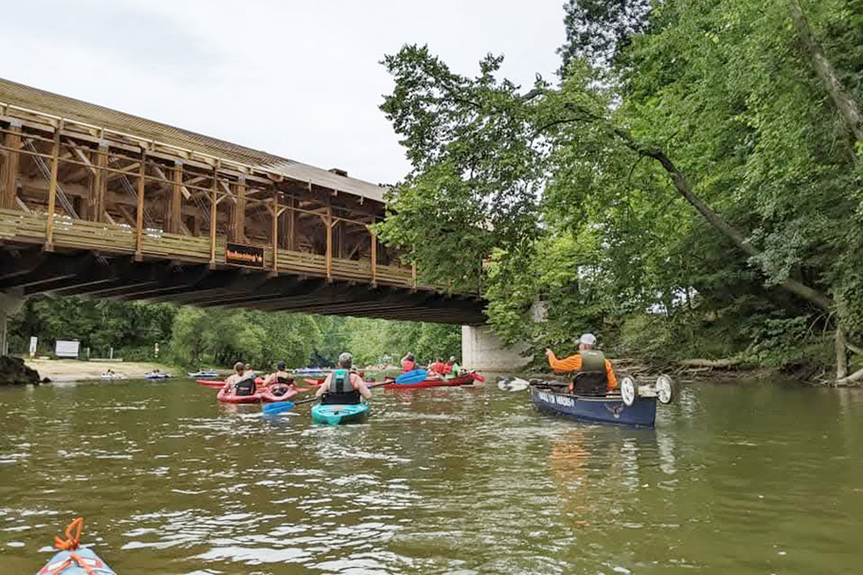
Wally Road Scenic Byway
The Walhonding Railroad connected Coshocton with Loudonville between 1893 and 1936. After the railroad shut down, its tracks were torn up and the metal was used to help with the war effort. Ultimately, the route fell into disrepair until 1940, when part of it became Wally Road. It was designated an Ohio Scenic Byway in 2004.
“The motto of the byway has always been: ‘A Touch of the Past Preserved for the Future, Shared with the Present’” says Gretchen Conrad, whose father, Bill Conrad, was a key supporter of the byway.
Starting in Loudonville, the 10.4-mile route passes through Ashland, Holmes and Knox counties. Summer visitors can get out of the car and head for the water at the Loudonville Canoe Livery or the River Run Canoe Livery. The area is also home to several camping spots, including campgrounds at River Run as well as Arrow Point and October Hills.
As the route continues into Holmes County, more camping and canoeing await at Wally World Riverside Resort. The county is also home to the 300-foot Spellacy Covered Bridge.
Heading toward Knox County, visitors can see several historic sites from the road, including a marker signifying the Greenville Treaty Line. The route ends just before Danville in Knox County, where small shops and restaurants can be found.
For more information about Ohio’s Scenic Byways, visit ohiobyways.com. For more Ohio Magazine coverage of our byways, visit ohiomagazine.com/scenicbyways.
For more Ohio travel inspiration, sign up for our Ohio Magazine newsletters.
Ohio Magazine is available in a beautifully designed print issue that is published 7 times a year, along with Spring-Summer and Fall-Winter editions of LongWeekends magazine. Subscribe to Ohio Magazine and stay connected to beauty, adventure and fun across our state.
Related Articles
")
Travel These 8 Scenic Byways This Summer
Summer offers the perfect time to take the back roads and storied routes, including these drives that reflect the history of our state and nation. READ MORE >>
")
4 Ohio Scenic Byways to Drive This Summer
Our state has 27 designated scenic routes that are perfect for summer road trips. These four across Ohio offer a glimpse into history and opportunities for outdoor recreation. READ MORE >>

3 Ohio Scenic Byways to Drive this Summer
These three driving tours share the story of the National Road, the wonders of the Hocking Hills and the heritage of life along Lake Erie. READ MORE >>
